



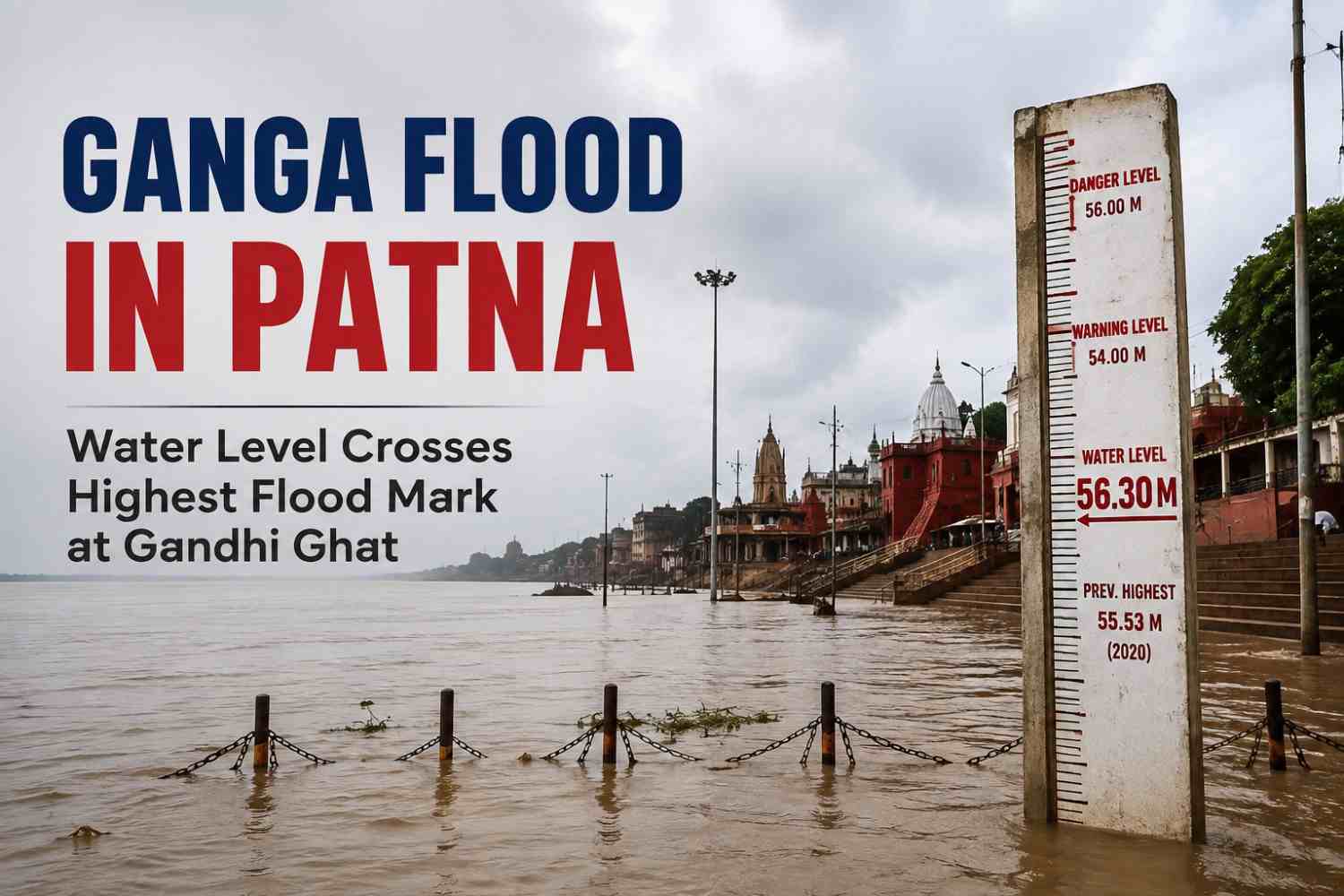
Ganga Flood in Patna has raised concerns as the Ganga crosses the highest flood level at Gandhi Ghat, increasing the risk of flooding in low-lying areas of the city. Here’s what the latest water-level data means, how it compares with historical flood levels, and what Patna residents need to know.
Ganga Flood in Patna: Ganga Crosses Highest Flood Mark at Gandhi Ghat
The Ganga’s rising water level at Gandhi Ghat has become a major concern for Patna as the river moves beyond the station’s recorded highest flood level.
According to Central Water Commission records, the highest flood level (HFL) at Gandhi Ghat is 50.52 metres, recorded on August 21, 2016. The danger level at the monitoring station is 48.60 metres.
The development is particularly significant because the HFL is a historical benchmark used to assess the severity of flooding at a river-monitoring station.
Recent reports indicate that the Ganga has been rising rapidly at Gandhi Ghat, with the river level increasing by around 10 cm within four hours during the latest surge.
What Is the Highest Flood Level at Gandhi Ghat?
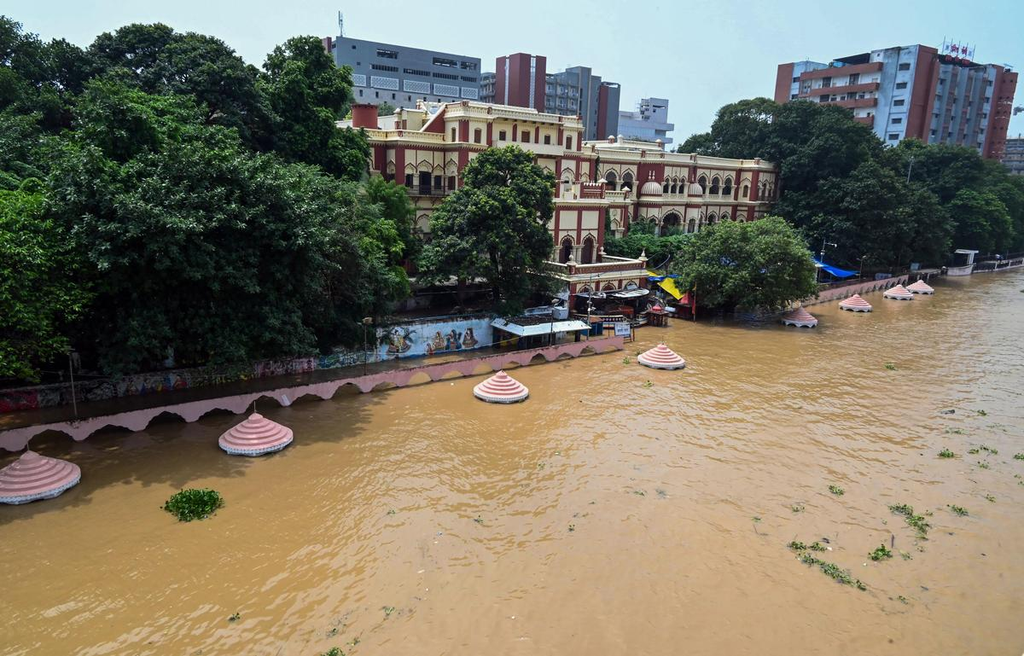
The highest flood level at Gandhi Ghat is 50.52 metres.
The Central Water Commission records show:
| Measurement | Level |
| Warning level | 47.60 m |
| Danger level | 48.60 m |
| Highest flood level | 50.52 m |
| Previous HFL record | August 21, 2016 |
The 50.52-metre level was established during the severe 2016 Ganga flood. At that time, the river broke the previous 1994 record and affected large populations living along the riverbank.
Why Is the Ganga Rising in Patna?
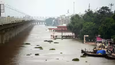
Several factors can contribute to a rapid rise in the Ganga’s water level at Patna.
1. Heavy rainfall
Persistent rainfall across Bihar and upstream areas can increase river inflows and push water levels higher.
Recent reporting has linked the latest rise in Bihar’s rivers to heavy rainfall in Bihar, Jharkhand and Nepal.
2. Water arriving from upstream
The Ganga receives water from numerous tributaries and upstream catchments. Increased flows can take time to travel downstream, meaning Patna’s river level can continue rising even after rainfall changes upstream.
3. Tributaries feeding the Ganga
Rivers including the Gandak, Kosi, Burhi Gandak, Punpun and other tributaries can influence flood conditions across Bihar.
When multiple rivers are simultaneously running at or above danger levels, the overall flood risk becomes more difficult to manage. Recent government response efforts have included deployment of rescue teams and boats in vulnerable parts of Bihar.
How Serious Is the Flood Situation in Patna?
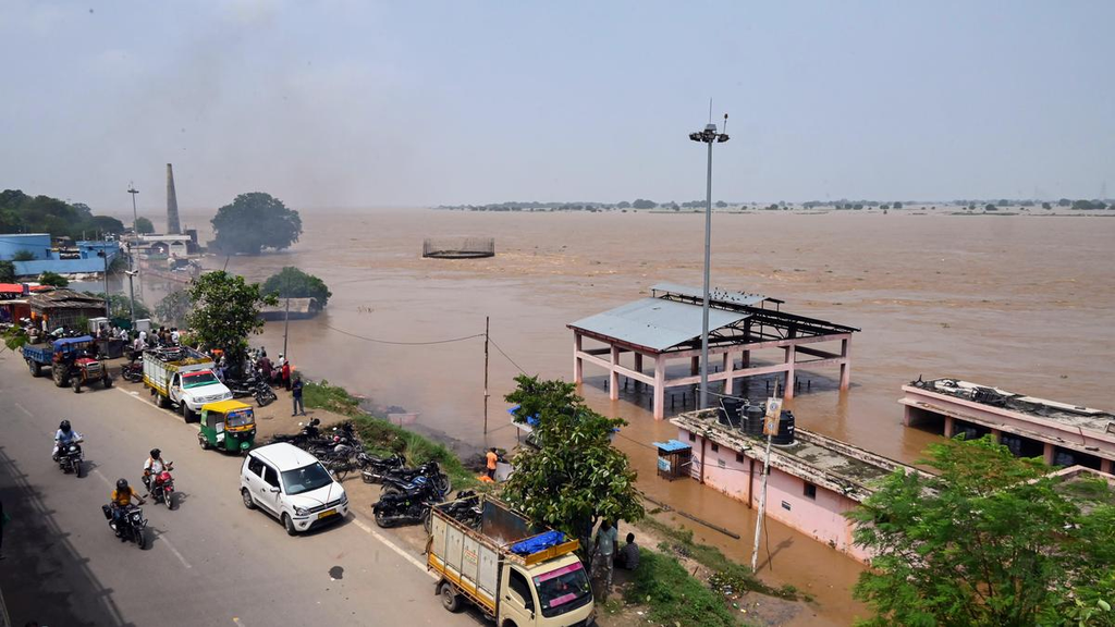
Crossing the highest flood mark is a serious warning, but the river level at one monitoring station does not automatically mean that every part of Patna is flooded.
Flood impacts depend on several factors, including:
- River level and rate of rise
- Rainfall in the catchment
- Embankment conditions
- Drainage and backflow
- Local topography
- Water levels in nearby rivers
- Duration of high water levels
Low-lying areas close to the river are generally more vulnerable to inundation.
Residents should therefore follow official advisories rather than judging flood risk solely by the water level at Gandhi Ghat.
Gandhi Ghat Water Level vs Danger Level
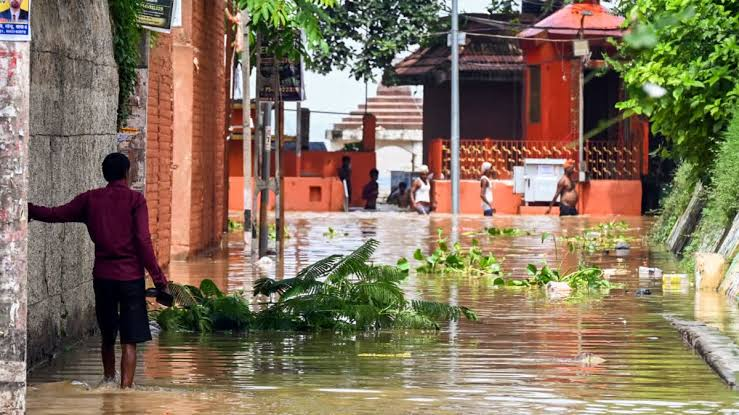
The difference between the danger level and highest flood level is important.
At Gandhi Ghat:
Danger level = 48.60 metres
Highest flood level = 50.52 metres
That means the historical HFL is 1.92 metres above the danger level.
This distinction matters because crossing the danger level indicates an elevated flood risk, while reaching or exceeding the HFL represents an exceptionally high river stage compared with the station’s historical record.
What Happened During the 2016 Ganga Flood?
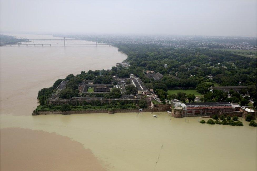
The previous benchmark of 50.52 metres was established during the major 2016 flood.
Historical reporting from that event states that the Ganga reached 50.52 metres at Gandhi Ghat on August 21, 2016, breaking the previous highest level of 50.27 metres recorded in 1994.
Central Water Commission records continue to list 50.52 metres on August 21, 2016 as Gandhi Ghat’s highest flood level.
The 2016 event is therefore an important reference point when assessing unusually high Ganga levels in Patna.
Which Areas of Patna Are Most Vulnerable?
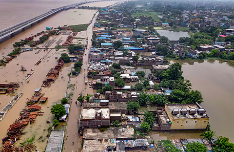
Flood vulnerability can be higher in low-lying settlements and areas close to the Ganga and its floodplain.
Depending on the severity and duration of flooding, authorities may monitor areas around:
- Riverbank settlements
- Diara areas
- Low-lying neighbourhoods
- Areas near drainage outlets
- Roads and settlements vulnerable to backflow
However, residents should rely on district administration and disaster-management advisories for area-specific evacuation or safety instructions rather than assuming that a particular locality is flooded based solely on the Gandhi Ghat reading.
What Should Patna Residents Do During Rising Ganga Water Levels?
If you live in a flood-prone or low-lying area, basic preparation can reduce risk.
Follow these precautions:
- Monitor official alerts from the district administration and disaster-management authorities.
- Avoid unnecessary travel near the river and flooded roads.
- Keep important documents, medicines, phones and chargers in waterproof bags.
- Keep drinking water and essential food supplies available.
- Do not walk or drive through moving floodwater.
- Keep children away from flooded areas, drains and riverbanks.
- Follow evacuation instructions immediately if authorities issue them.
- Avoid consuming water or food that has been contaminated by floodwater.
Frequently Asked Questions
What is the highest flood level of the Ganga at Gandhi Ghat?
The highest flood level recorded by the Central Water Commission at Gandhi Ghat is 50.52 metres, recorded on August 21, 2016.
What is the danger level of the Ganga at Gandhi Ghat?
The danger level at Gandhi Ghat is 48.60 metres, according to Central Water Commission records.
When did the Ganga record its highest flood level at Gandhi Ghat?
The current historical highest flood level of 50.52 metres was recorded on August 21, 2016.
Why is the Ganga rising in Patna?
River levels can rise because of heavy rainfall, increased upstream inflows and water entering the Ganga through tributaries. Recent reports have associated the current Bihar flood situation with heavy rainfall in Bihar, Jharkhand and Nepal.
Does crossing the highest flood level mean all of Patna will flood?
No. A river crossing its highest recorded level at one monitoring station indicates an extremely high river stage, but the actual impact varies by location, drainage, embankments, topography and other local conditions.
Is Gandhi Ghat’s water level the same as Digha Ghat’s?
No. Gandhi Ghat and Digha Ghat are separate monitoring locations and have different reference levels. CWC records list Gandhi Ghat’s HFL at 50.52 metres, while Digha Ghat’s HFL is 52.52 metres.
Key Takeaway
The Ganga crossing the highest flood mark at Gandhi Ghat in Patna is a significant flood-risk indicator. The historical HFL at the station is 50.52 metres, while the danger level is 48.60 metres.
The situation should be monitored closely because river levels can change rapidly when heavy rainfall and upstream inflows coincide.
For residents, the most important steps are simple: follow official warnings, avoid floodwater and riverbanks, prepare essential supplies, and evacuate if authorities issue instructions.
This article should be updated whenever the Bihar Water Resources Department, Central Water Commission or district administration publishes a new verified river-level bulletin.